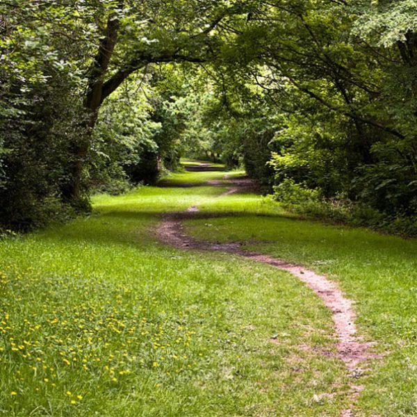
Features to explore
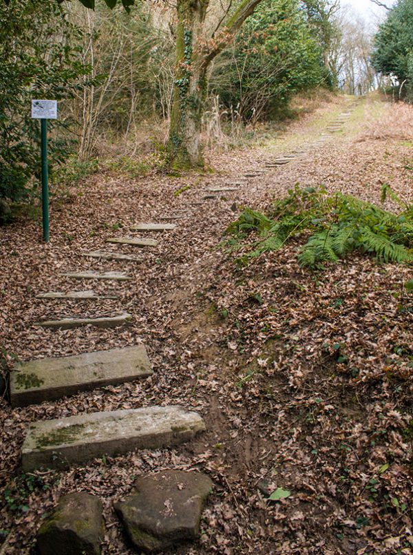
Pick and choose how to fill your visit with our extensive list of ideas for each Common. Maybe take a look at the new Marlpit ponds on Rusthall Common or take a circuit of the old race course on Tunbridge Wells Common?
-
Rocks
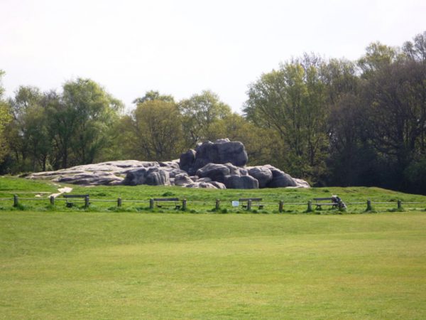
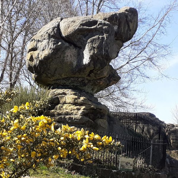
Wellington Rocks
Wellington Rocks (4 on map)
Wellington Rocks were named after then named Wellington Hotel, currently the Travel Lodge, on Mt Ephraim. In earlier times they were variously described as the High Rocks on Mount Ephraim, and Castle Rock (either named after the nearby Castle Tavern, or because of the shape of rocks’ highest point).
Early nineteenth century guides report that “small transparent pebbles are found on the paths of the Common, especially after rain. These crystals are called ‘Tunbridge Wells diamonds’, and, cut and polished, form brilliant additions to the jewel-case.” Small-rounded pebbles can still be seen today embedded in the sandstone, and it was probably the most attractive of these, eroded out of the rock, that were collected.
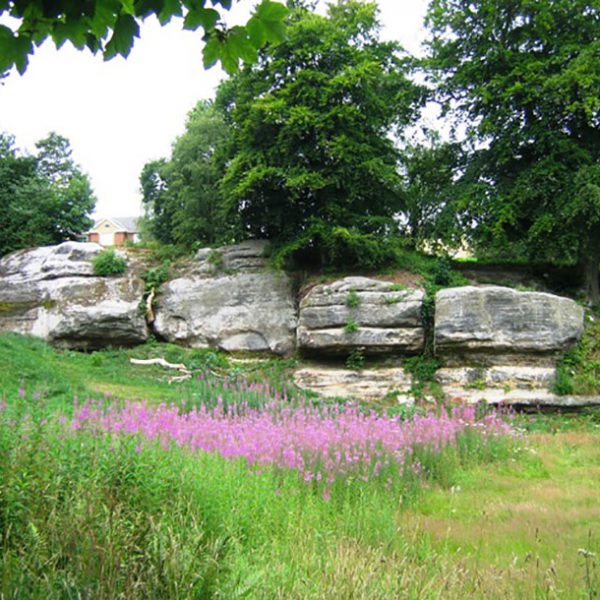
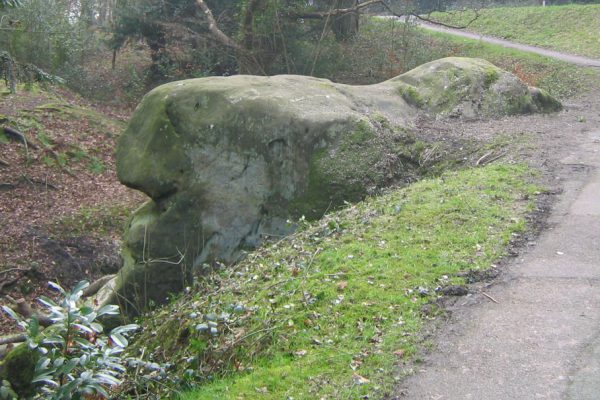
Mt Edgcumbe Rocks
Mt Edgcumbe Rocks (5 on map)
Mt Edgcumbe Rocks were well known in Victorian and Edwardian times, and popular vantage points for views across the town. They were known to children of the mid-twentieth century as the Devil’s Dyke. A pond at the foot of the rocks was filled in in 1879. By the 1960s, the open grassy space in front of the rocks had become overgrown by scrub which obscured them completely, but the area was cleared in 1994-1995.
-
Ponds
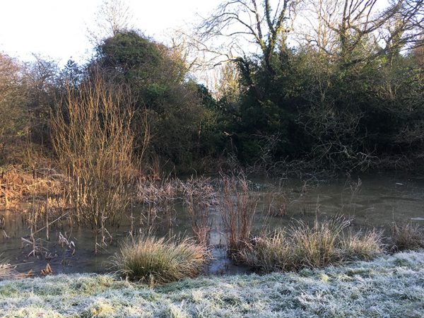
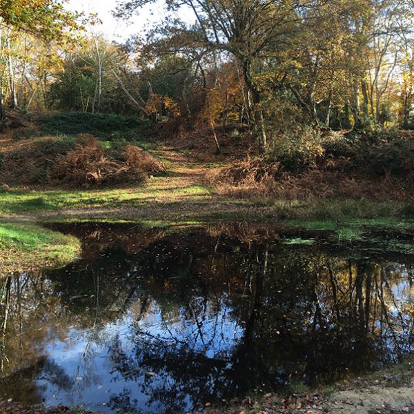
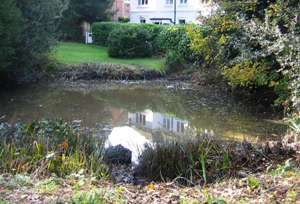
Brighton Lake (18 on map)
Brighton Lake is fed by a chalybeate spring (visible on the northern edge). It was excavated in 1858 as part of a scheme instigated by William Law Pope, minister of King Charles’ church, to provide work for the town’s unemployed, wages being paid by public subscription. It was nicknamed Pope’s Puddle, and Pope’s Folly.
The official name relates to the fact that it lies alongside the road to Brighton. Today the pond is an important habitat for wildlife, including frogs, toads, newts, grass snakes, and dragonflies.
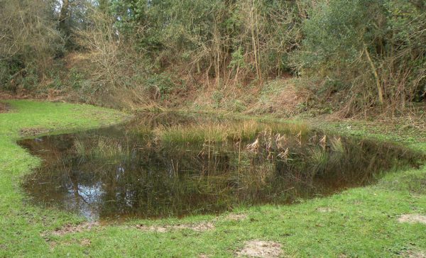
Fir Tree Pond
Fir Tree Pond (21 on map)
Fir Tree Pond was a noted beauty spot in Victorian and Edwardian times, named from a pair of Scots pines (affectionately named Darby and Joan) with a seat around them which stood on top of the slope above.
Having succumbed to old age, the firs were cut down in 1914 and replaced – the replacements are still to be seen today (2020). The pond is situated in an extensive hollow described in 1957 as an ‘old quarry’. It was restored in 1992.
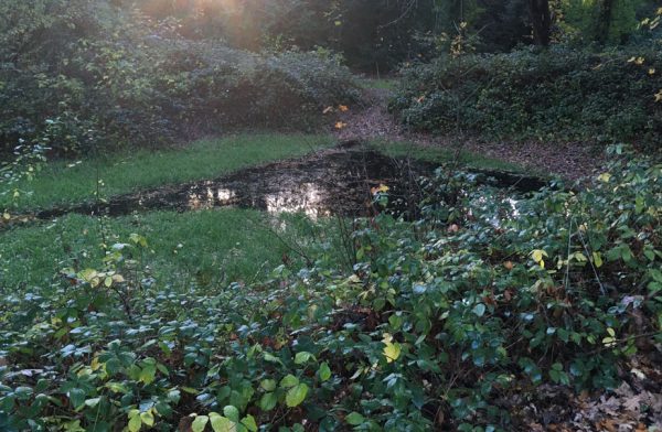
Bracken Cottage Pond
Bracken Cottage Pond (22 on map)
Bracken Cottage Pond is a modern name for a survivor of several informal ponds scattered over the Commons up to the mid-nineteenth century and maintained as watering places for cattle and sheep.
Most were filled in at various dates between 1850 and 1900. This pond was restored in 1992. It is fed by a spring via a small watercourse to the east.
Cabbage Stalk Lane Pond
Cabbage Stalk Lane Pond (20 on map)
Cabbage Stalk Lane Pond, named as it lies near the path, sometimes referred to as the Old Road to High Rocks, that joins the eastern end of Cabbage Stalk Lane (near the Cottage). It lies just above The Old Road, in an old marl pit. The pond is sometimes dry; it dried up completely in springtime 2017 and the Warden had to rescue the tadpoles by transferring them to the newly restored Bracken Cottage Pond. In springtime 2020, the same Warden saw that the pond was full of frogs.
-
Commemorative trees
Queen Anne Grove
Just to the north of Royal Victoria Grove was the earlier Queen Anne’s Grove, planted for the coronation of Queen Anne in 1702 and replanted in 1811; but this never did well and died out before 1838.
Jubilee Oaks
Contemporary press accounts report that a pair of scarlet chestnuts were planted near Fonthill in May 1935, to celebrate George V’s Silver Jubilee. It seems these trees did not survive, and that the two oaks on the site today are replacements.
Royal Victoria Grove
Royal Victoria Grove (3 on map)
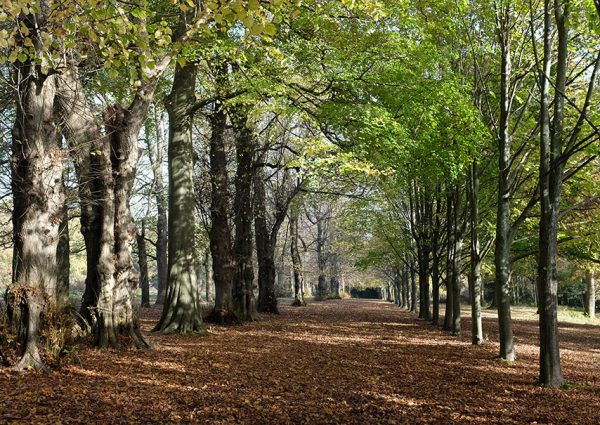
Royal Victoria Grove was planted in February 1835 to commemorate visits to the town by Princess Victoria with her mother the Duchess of Kent. Forming a double avenue, sycamores, limes, and elms were planted in three separate rows, 25 apart; the 44 trees in each row were kept twelve and a half feet apart. Some of the trees had to be replaced in later years and often did not conform to the double-avenue arrangement. The elms succumbed to disease in 1972, and in 1992 the third row was replanted to celebrate the fortieth anniversary of Elizabeth II’s accession. For a few years from 1911 a moveable bandstand was set up to the south. To the north of the Grove is a small patch of surviving heathland, a type of vegetation once much more widespread on the Common.
Princess Anne Oak
Princess Anne Oak (19 on map)
Overlooking London Road, between Mount Edgcumbe Road and the Vale Road corner, is an oak tree said to have been planted around 1700 to commemorate the several visits, between 1684 and 1698, of the Princess Anne (later Queen). The Victorian railings around the tree were restored in 1995, and a plaque affixed.
The Lutwidge Group
The pine tree on the south corner of the junction between Hungershall Park and Major York’s Road is the most conspicuous survivor of five planted in November 1895 by the mayor elect, Major C R Fletcher Lutwidge. This was part of a scheme promoted by the Tradesmen’s Association, by which individuals and organisations subscribed around 150 trees.
Salomon Group
Trees planted near the junction between Major York’s Road and Fir Tree Road, planted between those roads by mayor, in 1895 by Sir David Lionel Salomons, subsequently succumbed to a gorse fire.
Jubilee Oak
Jubilee Oak, located halfway between The Forum and the junction between Castle and Eridge roads, was planted in June 1887 by Mrs Stone Wigg, wife of the Chairman of the Local Board, to celebrate Queen Victoria’s Golden Jubilee.
Jubilee Lime
Jubilee Lime, located to the north of the northern corner of the upper cricket field, was planted in March 1977 to commemorate Elizabeth II’s Silver Jubilee.
The Charter Group
A group of limes located on the east side of Fir Tree Road, north of the junction between Hungershall Park and Major York’s Road, was planted by John Stone Wigg, the first mayor of Tunbridge Wells, to celebrate the granting of borough status to the town in February 1889.
Strange’s Avenue
Edward Hilder Strange, proprietor of the Royal Kentish Hotel, had planted an ornamental avenue between 1810 and 1820 leading down to his front entrance. It originally consisted of forty sycamores and chestnuts, but many of these have been replaced in subsequent years.
Coronation Chestnut
A red-flowered tree was planted in December 1911 near the path leading to the easterly corner of the Common, near Vale Road, to commemorate the coronation of George V. The tree is now surrounded by other trees that have grown thereafter.
-
Other features
Racecourse
Racecourse
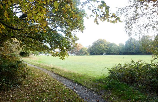
The racecourse appears on Bowra’s map of 1738 and remained in use until 1851. Race meetings were held for two days each year, in August or September. The winning post, stand, and enclosure stood on the north side of the present upper cricket ground. The Duchess of Kent and Princess Victoria attended in 1834. In 1845 residents petitioned for the suppression of the races, on the grounds that they were a cause of drunkenness and riotous behaviour. After races ceased to be held, the course (apart from the section crossing the Cricket Ground) was preserved as a footpath and bridleway and can still be followed today. Along the southern section, between Major York’s Road and Hungershall Park, is a clearing where heathland restoration is in progress. Near the north west corner is the site (formerly marked by a plaque) of a thatched shelter destroyed by a flying bomb in 1944, with the death of an elderly resident. Hidden in the undergrowth north of the car park where the racecourse meets Fir Tree Road is the site of a small quarry.
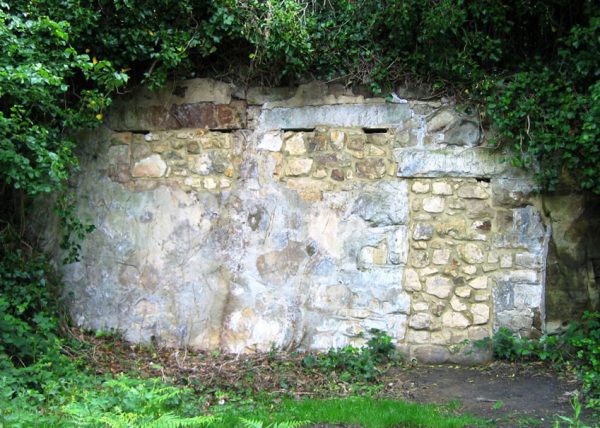
Bat refuge
Bat refuge
What were once public toilets were transformed into a refuge for bats in 2007. The work involved closing up the old doorway and windows with sandstone, leaving small gaps at the top for the bats to enter and exit. A pipe was placed at the very bottom of the doorway at the left for reptiles.
Lower cricket ground
Upper cricket ground
Although cricket was played informally on the site of the upper cricket ground from the mid-eighteenth century, its status as an official ground dates from 1839, when the newly formed Tunbridge Wells Cricket Club were given permission to use and improve it. It was enlarged in 1859 and 1875. County matches were played here from 1845 to 1880, but they ceased due to the poor condition of the pitch which was regularly trampled by the public and grazing animals. On either side of the pavilion are flowering cherries planted in June 1953 to commemorate Elizabeth II’s coronation. Around the cricket ground, and elsewhere on the Common, can be seen several cast iron ‘hawthorn’ benches dating from the 1860s and restored in the early 1990s; subsequently, many replicas of the originals have also been made and installed.
Lower cricket ground
First used as a cricket pitch in the 1850s by the pupils of Romanoff House School. From 1860 it was the site of an annual bonfire on 5 November, and it was regularly used as a venue for civic celebrations of coronations and jubilees. It was levelled and railed in 1885-1886. There was a Territorial Army encampment here in 1914. The original railings, along with those of the Higher Cricket Ground, were taken for the war effort in 1942.
Cold bath and chalybeate spring (14 & 1 on map)
The Cold Bath was constructed around 1766, falling into disuse with the construction of the Bath House in 1804. The well was sunk over a chalybeate spring about 1700. Both structures became buried in the early nineteenth century and were rediscovered during road works in 1971.
Mt Ephraim Promenade
Originally levelled as a turf walk, Mt Ephraim Promenade, on the northern edge of the Common in 1881, was later gravelled (1891) and asphalted (1925). Just as in the early nineteenth century seaside resorts modelled themselves on the older spas, so in later times Tunbridge Wells adopted seaside terminology. Alongside the Promenade is one of the Common’s surviving areas of acid grassland, an important wildlife habitat.
Milestone
Near the end of Major York’s Road, on the eastern side, is a small pillar of local sandstone. It originally indicated thirty-six miles to London, but is now illegible. It dates from at least the early nineteenth century.
Terrace Walk
Besides forming Brighton Lake, Reverend Pope’s used his team of unemployed workers to create a ‘greensward terrace walk’ above the pond.
The Brook
The small stream which once marked the county boundary flowed beside what is now Cumberland Walk, behind the Lower Walk of the Pantiles, and along Eridge Road before crossing the corner of the Common below the Cottage, the footpath to which once crossed a small bridge. In 1853, following years of complaints that it had become an open sewer and was a hazard to public health, it was finally enclosed in a barrel drain at the expense of the Local Board, assisted by a contribution from the Earl of Abergavenny. It now emerges in the garden centre beyond the western boundary of the Common. Although local residents never dignified it with a name, it is the beginning of the River Grom.
Bishop’s Down
Bishop’s Down refers to the triangular portion of Tunbridge Wells Common that lies between Bishop’s Down Road on the north, with adjacent houses, and the section of the A264 on the south, also known as Bishop’s Down Road. The portion of the Common preserves the ancient name of the entire Common. There was formerly a pond here, but in 1865 it was filled in.
-
Structures on the Common
The Forum (16 on map)
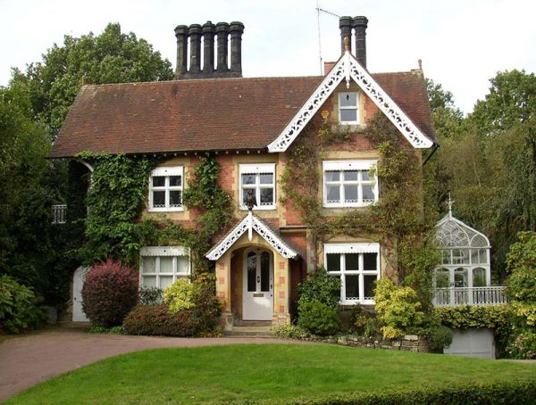
The Forum was built in 1939 by the local Council to provide “rest rooms and general conveniences” for locals and visitors enjoying the Common. It replaced a forge, coach builders’ workshop, and attached cottage (Fonthill House) dating from 1833. An earlier forge on the site is shown on Bowra’s map of 1738. This is said to be the site of the cottage occupied by Mrs Humphreys, who provided Lord North with a cup to drink from the chalybeate spring when he discovered it in 1606. The buildings on the east and west of Fonthill were from early times an untidy clutter of small cottages and rough working buildings. There was a garage on the site of the Kentish Stables, then belonging to the Royal Kentish Hotel opposite, and redeveloped in about 2015 as a small block of apartments. The present pavilion has functioned since 1993 as a live music venue.
St Helena (9 on map)
St Helena was built between 1828 and 1838 on the floor of a small stone quarry and used in early times as a lodging house. It is located almost opposite the Royal Wells Inn on Mt Ephraim, on the eastern end of the Common. It replaced an earlier and much smaller cottage shown is shown in several eighteenth and nineteenth century illustrations along with a second small structure to the north, on the other side of the rock. At the foot of the rocks a manhole cover marks the entrance to caves excavated for sand and open to the road until its level was raised in a controversial road levelling scheme carried out by the local Turnpike Trust in 1833. Residents complained that the loss of the caves spoiled the picturesque and much illustrated first view of the town which visitors saw as they travelled in from London. The caves were reopened at the outbreak of World War II to serve as air raid shelters.
Mt Edgcumbe
Mt Edgcumbe was the hillock named after Emma, Dowager Countess of Mount Edgcumbe, who spent the summers of 1795-1797 in the town and was the only daughter of Dr John Gilbert, the Archbishop of York from 1757-1761. The site lies between the top (eastern) end of Mt Edgcumbe Road and Mt Ephraim. The group of three buildings on the hillock here appear as early as Bowra’s map of 1738. They were originally two lodging houses (Mount Edgcumbe, now a Hotel, and Ephraim Lodge); a private house (Mount Edgcumbe Cottage) is now located between the other two structures. The Arctic explorer Rear Admiral Sir William Parry stayed at what is now the hotel in 1839.
Romanoff Lodge
Romanoff Lodge (13 on map)
Romanoff Lodge was built in 1852 by Thomas Allfree on the site of a late eighteenth century cottage occupying, about halfway down Castle Road, along with Castle Cottage, the site of old gravel or sand pits. Allfree was the proprietor of Romanoff House School (occupying the building in London Road now known as Vale Towers), founded by him in the 1830s; the present Rose Hill School is in lineal descent. Allfree used the name Romanoff because of the time he spent previously in Russia, as an English-language tutor to the children of Czar Nicholas I’s children.
Belleville (10 on map)
Belleville, the most easterly structure on Tunbridge Wells Common was probably built about 1840. Thackeray describes a house on the Common near Rock Villa in which he stayed as a child in 1823; this has been identified with Belleville but was more likely Gibraltar, the only one of the three rock built cottages at the apex of the Common known to have been used as a lodging house at that date.
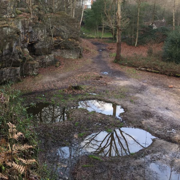
Gibraltar Cottage and Rocklea (7 on map)
Gibraltar Cottage and Rocklea was built as a single lodging house in the 1820s on the site of an earlier and smaller cottage of the same name. It is located almost due north of the junction between London and Church roads. It was occupied by members of the Tunbridge-ware making family of Burrows from the 1820s to about 1845. It was James Burrows who invented the technique of creating mosaics from wooden tesserae around 1830.
Having fallen into decay, it was restored and altered in 1970/1971. The name is an allusion to the rocks on which the cottage stands; in the past Gibraltar has been used as a general term for the rocky eastern apex of Tunbridge Wells Common. Until the mid-nineteenth century, a pond known as Parson’s Pond existed below the cottage alongside London Road.
York Cottage (2 on map)
York Cottage is currently occupied by an architecting business. The building is located just north of the junction between Major York’s Road with Eridge Road, on the western side of Major York’s Road and was built by George Mercer, a chaise driver, who had obtained permission from the Freeholders and the Lady of the Manor (Elizabeth Shorey) in 1820 to enclose a small portion of the Common for the purpose. It is a survivor of a number of small cottages on the Commons, most of which were replaced by more substantial structures in Victorian times.
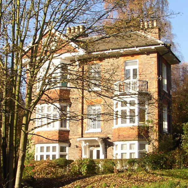
Highbury
Highbury
Highbury was built around 1906 on the site of Exeter Villa, a late eighteenth or early nineteenth century lodging house. It lies on the southern edge of Tunbridge Wells Common opposite Castle Street on the other side of London Road. Near the house is one of the Common’s surviving areas of acid grassland, characterised by the nest mounds of the Yellow Meadow Ant. Lizards are frequently to be seen here.
Onslow House
The original Onslow House, on Castle Road next to and south of Romanoff Lodge, was built in the early 1880s on the site of the late eighteenth century Castle Cottage. As a condition of permission to build, an old sand pit on the opposite side of the road latterly used as a stonemason’s yard was filled in and restored to the Common. Onslow House was replaced by the present row of houses in 1965.
-
Structures beside the Common
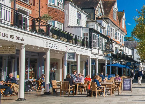
The Pantiles
The Pantiles
The Pantiles, formerly known as The Walks and the (Royal) Parade, which led from the well that gave the town its name (see on Google Maps). They are a star attraction of Tunbridge Wells and owe their origin to the presence of, and built adjacent to, the chalybeate spring discovered in the early 17th century.
Church of King Charles the Martyr
Understood to be the first permanent structure in Tunbridge Wells, the Church of King Charles the Martyr was built in 1676. It is located above the north end of the Pantiles. Princess Victoria, then a girl of sixteen, attended the church, a large brass plaque now attached to the panelling commemorates her visits.
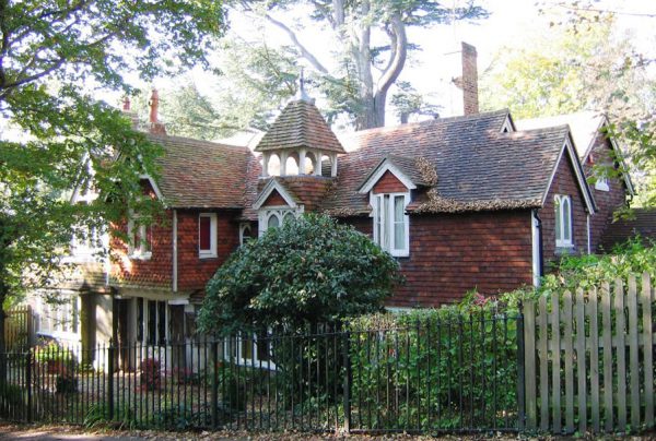
The Cottage
The Cottage
The current Cottage is an enlargement of the late seventeenth- to early eighteenth- century Kentish Cottage, named after the long-vanished farmhouse known as Kentish Villa a little to the north. It is located at the eastern end of Cabbage Stalk Lane. It was the summer retreat from about 1850 of the Scottish preacher Dr John Cumming. In front of the Cottage are oaks probably planted around 1700 to mark the boundary of the Common: others of similar age can be seen further along the path to the north.
Gorse and Bracken Cottages
Gorse and Bracken Cottages are located on the western edge of the Common. They were built about 1912 on the site of the early Victorian Spring Bottom Cottage, also known as Shoebridge’s Cottage, after a laundress who lived there in the 1860s.
Thackerays
Located close to the eastern end of Tunbridge Wells Common, on the corner of London and Mount Ephraim roads, Thackerays is now a restaurant. It was a lodging house of the late seventeenth century known as Rock Villa and where novelist William Makepeace Thackeray (1811-1863) stayed in 1860. In a letter his daughter Lady Ann Isabella Richie described Rock Villa as “an old wooden house at the foot of Mt Ephraim”. William Thackeray greatly enjoying his walks over the Common, which he describes in his Roundabout Papers.
Summerhill House
Summerhill House, is located at 73 London Road. A notable occupant was Jacob Bell MP, founder of the Pharmaceutical Society of Great Britain in 1841 which become the Royal Pharmaceutical Society in 1988. By the 21st century the building was in a poor state but was awarded for the work done to restore it in 2012, the Tunbridge Wells Civic Society.
Ashton Lodge
Known earlier as Jordan Lodge, Ashton Lodge was shown on John Bowra’s 1738 map as belonging to John Jeffrey. Its most famous occupant was Thomas Bayes, who resided there from 1734 to 1761. Thomas was the minister of the Presbyterian Church that located in Little Mount Sion, but his name became known worldwide for his statistical work that led to Bayes Theorem, a mathematical model for estimating probabilities.
Earl’s Court Hotel
Earl’s Court Hotel, thereafter Reliance House and now Molyneux Place, is said to have once been the residence of Mrs Tighe, a noted member of the local gentry, and had been built by Sir Edmund King (1629-1709), a physician to King Charles 2nd. It is located on the corner of Molyneux Park Road and Mt Ephraim. An old postcard shows it sitting proudly on Mt Ephraim at the top end of Castle Road, much more prominent than that road is today (2020).
Jordan House
The premises at 68 London Road, Jordan House, earlier known as Jordan Place and built around 1685. They were occupied in the first half of the nineteenth century by Tunbridge-ware makers Humphrey Burrows, Senior and Junior. Their factory and show room were patronized by Princess Victoria, as is commemorated on a well-known print, by W Day of London.
Manor House
The Manor House (6 Bishops Down) is not a true manor house, but a late seventeenth century lodging house acquired along with other property at Bishops Down by George Kelley at the time when he purchased the Manor of Rusthall. In lodging house lists of around 1800 it appears as Mrs Shorey’s Great House, after the then Lady of the Manor. The present name dates from about 1822.
Mt Ephraim House
Charles II and Queen Katharine stayed at Mt Ephraim House (87 Mt Ephraim) in 1663 while their court camped on Tunbridge Wells Common. The house served as the Assembly Room for the entertainment of visitors from 1665 to 1670. It was substantially altered in the 1840s, acquiring an extra storey and a new facade. Together with the Chalet, built in its grounds around 1800, it served as the Tunbridge-ware manufactory of William Fenner from the 1790s, the business being subsequently taken over by Edmund Nye around 1840 and Thomas Barton in 1863. Manufacture continued until Barton’s death in 1903. On the edge of the Common around the corner of the boundary wall is a row of seats: this area was traditionally noted as a sun trap and named the South of France.
Royal Wells Inn
Built in 1834 as the Mt Ephraim Hotel, and located near the northern end of Tunbridge Wells Common on Mt Ephraim, the now named Royal Wells Inn owes its title to Queen Victoria, who visited frequently as a young Princess in the early 19th century, and later granted the use of her coat of arms, which is proudly displayed at the top of the building.
Spa Hotel
What is currently (2020) the Spa Hotel (located above the northern end of Major York’s Road) was built in 1765 by Sir George Kelley, Lord of the Manor, as Bishops Down Grove. It was purchased from his heirs by Major Martin Yorke of the East India Company (after whom the road is named) in 1772. Its life as a hotel dates from 1878, when, following enlargement, it was opened as the Bishops Down Grove Spa and Hydropathic Sanatorium. On the strip of the Common in front of the hotel is a drinking fountain erected in 1887 in memory of the Hon. Francis and Lady Georgina Molyneux. Francis Molyneux moved to Tunbridge Wells in 1853, living first at Gibraltar Cottage and subsequently building Earls Court (now Reliance House) on Mount Ephraim. He was a leading member of the Freeholders, as well as the Local Board. Nearby, a plaque indicates an oak planted in July 1954 to commemorate a summer school held by the Men of the Trees, an early environmental group, at the Hotel.
While he owned the house, Major Yorke gained a reputation for his lavish entertaining and even welcomed Princess Victoria, later Queen, as a guest. (One can read a little more about Major Yorke in the book by Paul Amsinck, Tunbridge Wells, and Its Neighbourhood, Illustrated by a Series of Etchings, and Historical Descriptions. The text of this book is also available online.)
The Major Yorke
Previously known as the Brokers Arms, was renamed in 2002 as the Major Yorke, under the ownership of the Spa Hotel. It was a 16th century coaching inn. It was renamed after Major Martin Yorke who bought the Spa Hotel in 1772, after serving under Lord Clive of India and making his fortune with the East India Company. It has been closed for since 2018.
Wellington hotel
The Wellington Hotel (now Travel Lodge) opened in 1875 by John Braby. Braby was an admirer of the Duke, whose wife stayed in the town on several occasions.